
Search by Keyword
Search by Department
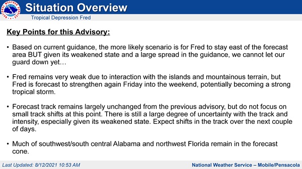
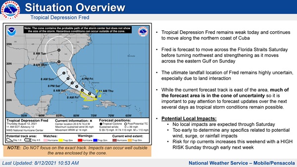
All Departments Administration Corrections Development Services Facilities Management Human Resources Information Technology Library Services Management and Budget Services Natural Resources Management Neighborhood and Human Services Parks and Recreation Public Safety Public Works Veterans Services Waste ServicesEscambia County is encouraging residents and visitors to closely monitor official weather sources for information regarding Tropical Depression Fred. The National Weather Service of Mobile is forecasting Tropical Depression Fred to move across the Florida Straits before turning northwest and strengthening into a tropical storm as it moves across the eastern Gulf on Sunday, Aug. 15.
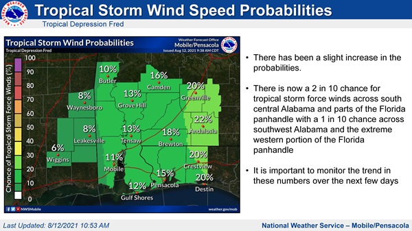
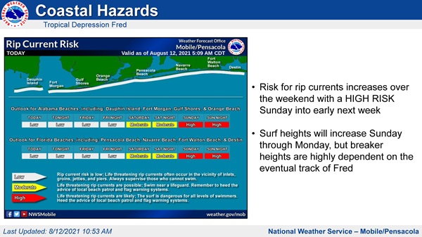
While it's still too early to determine potential impacts to Escambia County, the latest forecast from the National Hurricane Center has Fred approaching the eastern Gulf Coast Sunday, Aug. 15 as a tropical storm; however, there remains some uncertainty regarding exactly where Fred will eventually make landfall. While the current forecast track is east of the area, much of the forecast area is in the cone of uncertainty, so it is important to pay attention to forecast updates over the next several days as tropical storm conditions remain possible. A local risk for rip currents will increase this weekend with a high risk on Sunday through early next week. More information on the flag system is available online here.
Residents are reminded to follow official sources for storm information such as National Weather Service, National Hurricane Center, Escambia County Emergency Management and City of Pensacola.
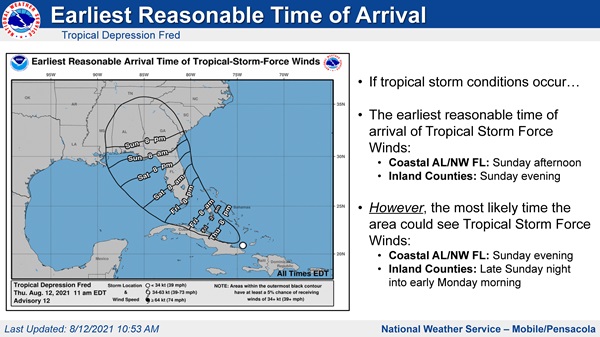
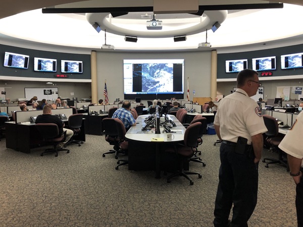
"Emergency Management will continue to monitor Tropical Depression Fred over the weekend," said Public Safety Director Eric Gilmore. "Trigger points have been set and the responsible agencies have been notified. Citizens should remain vigilant and make preparations before the weekend. There are many unknowns, so it is important to be prepared and make sure your plans are in place. Currently, tropical storm force winds are predicted to be possible late Sunday night into Monday."
Escambia County Emergency Management is closely monitoring this system. Residents are urged to do the same by monitoring our local media for the most up-to-date forecasts several times a day.
Residents are encouraged to prepare their disaster kits now, which should include seven days of food and water supplies for after the storm arrives. Residents are also encouraged to fuel all vehicles and generators, and prepare all medications needed by family and pets. Individuals should also consider having at least two emergency supply kits, one full kit at home and smaller portable kits in their workplace, vehicle or other places they spend time. Remember, this year's disaster kit might need to look a little different if you're planning to go to a shelter—make sure to include face coverings, hand sanitizer and disinfecting wipes.
Sand is available now at the following locations:
The sand is available on a first-come, first-served basis. Residents must bring their own sandbags and shovels to one of the following locations. View map of sand locations here.
Follow These Tips to Prepare for a Storm
Follow these tips to stay safe during severe weather:
For the latest information on severe weather impacting Escambia County, residents are encouraged to sign up for emergency alerts on myescambia.com, like Escambia County Emergency Management on Facebook and follow @BeReadyEscambia on Twitter.
Stay informed with these additional local resources:

The mission of Escambia County government is to provide efficient, responsive services that enhance our quality of life, meet common needs and promote a safe and healthy community.
Under Florida law, IP addresses and both the content of emails and email addresses are public records. If you do not want your IP address, the content of your email, or your email address released in response to a public records request, do not send electronic mail to this entity. Instead, contact this office by phone or in person.
All content © 2026 Escambia County, FL and its representatives. All rights reserved.

