


Escambia County residents are encouraged to monitor potential severe weather beginning Tuesday evening, March 4.
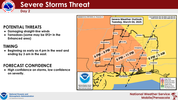
A line of storms will move across the area late Tuesday afternoon and continue into the evening, with the timing for Escambia County expected to be between 6 p.m. and 11 p.m., according to the National Weather Service of Mobile. Potential threats include damaging straight-line winds and possible tornadoes, with the greatest risk area for tornadoes in the central and northern portions of Escambia County.
According to NWS, most of Escambia County is in an Enhanced Risk area, with the southern part of the county in a Slight Risk area.
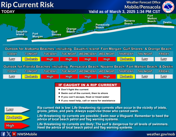
The following advisories are also in effect for Escambia County:
Residents are encouraged to remain weather aware and continue monitoring the forecast for updates. Ensure you have multiple ways to receive warnings and know your safe place ahead of time.
For more information, monitor the local media and legitimate online and social media sources like Escambia County Emergency Management, US National Weather Service Mobile and Florida SERT.
More information on what to do before, during and after a storm is available online at MyEscambia.com/BeReady. You can also like Escambia County Emergency Management on Facebook and follow @EscambiaBeReady on Instagram for the latest news and updates on emergencies impacting our community.
View Escambia County Emergency Management's recent "A Minute with EM" episode breaking down the upcoming storm here.

The mission of Escambia County government is to provide efficient, responsive services that enhance our quality of life, meet common needs and promote a safe and healthy community.
Under Florida law, IP addresses and both the content of emails and email addresses are public records. If you do not want your IP address, the content of your email, or your email address released in response to a public records request, do not send electronic mail to this entity. Instead, contact this office by phone or in person.
All content © 2026 Escambia County, FL and its representatives. All rights reserved.